
[INQ. NO. 2212E16] IGIS is an ICT solution company specialized in developing geographic information systems and geospatial data-based drone solutions.
IGIS satisfies its customers’ needs in various industries in the public & private sectors with its solutions such as IGIS, a geographic information system; DFOS, a drone integration solution that encompasses drone flight, control and data management; and FMS, a specialized system for field management.
With its own wealth of knowledge and practical experience, IGIS supports its partners in a variety of fields.
Drone flight, control, and data management functions
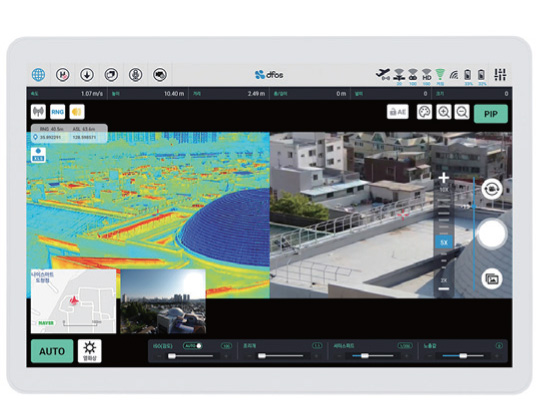
DFOS solution is an integrated solution that can build and utilize an efficient work system through real-time video shooting and data transmission using drones in various industries such as forestry, agriculture, and construction.. It provides drone flight, control, and data management functions.
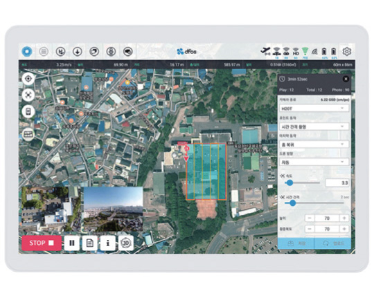
DFOS consists of DFOS Pilot, Control System, Viewer, and Streaming Viewer. DFOS pilot is an app that allows users to conveniently control drones. Its distinguished 3D flight function supports the drones flying at a stable altitude even in invisible areas. Control system is a system that manages the information, photos & videos, and flight history obtained from drones.
Drone image management system & 360° drone panoramas creation service
IGIS also provides DFOS IMS and DFOS Panorama Platform.
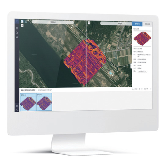
DFOS IMS is a management system for drone photography. High-resolution, large-capacity images can be uploaded to the system and various functions including statistics, analysis, and automapping are available.
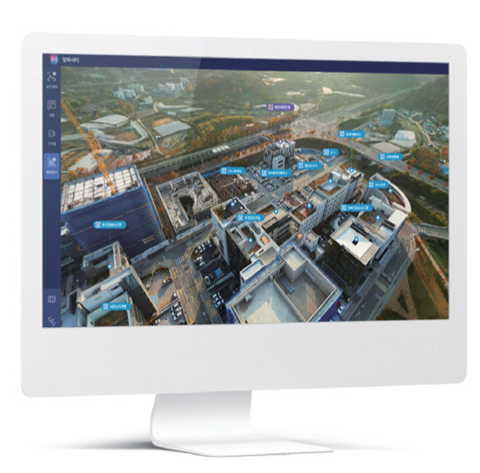
DFOS panorama platform is a web service that converts drone photos into a 360-degree panorama. It enables users to create a geospatial data layer of a certain area on the images. Users also can attach symbols to the image for identification of buildings and geographical features.
korean-electronics.com | Blog Magazine of korean electronics, brands and Goods


Leave a comment